Bukid Series 2: Mt. Pinatubo
By: Erika Florence P. Inez

Aerial view of Mount Pinatubo
(http://noypicollections.blogspot.com/2011/07/mt-pinatubo-dilemma-turns-to-tourist.html)
Pinatubo was once obscure, covered with dense forests and is supported several thousand indigenous Aetas. It was a little known volcano and it had been dormant for almost 400 years. But in 15 June 1991, Mt. Pinatubo erupted, and it became the second largest volcanic eruption of the 20th century. Complicating the eruption was the appearance of Typhoon Diding (International name: Typhoon Yunya), bringing a lethal mix of ash and rain to the neighboring towns and cities. Accurate predictions at the onset of the eruption led to the evacuation of thousands of people, saving many lives. However, the surrounding areas were damaged by ash falls, pyroclastic materials, flooding lahars and rocks from the eruption.
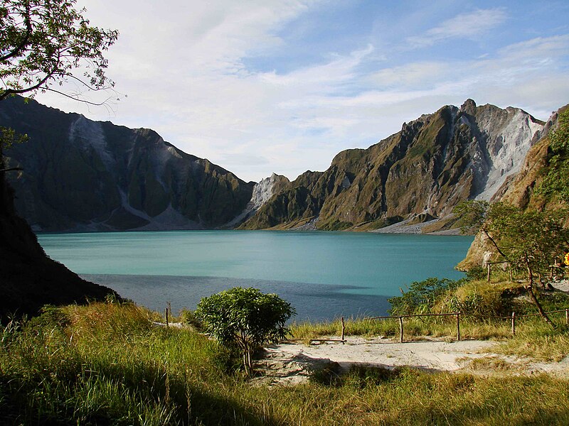
The crater lake of the 1991 eruption seen in 2008
ChrisTomnong - Own work, CC BY-SA 3.0
(https://commons.wikimedia.org/w/index.php?curid=6898828)

The overall geological study in 1983 and 1984 made by F. G. Delfin for the Philippine National Oil Company as part of the surface investigations of the area before exploratory drilling and well testing for geothermal energy sources in 1988 to 1990 brought Delfin to the conclusion that there are two life histories of Mount Pinatubo—The "ancestral" and "modern" Pinatubo.
The "ancestral" Pinatubo seem to have begun 1.1 Million years before the "modern" Pinatubo, and most of the rugged land around the present Pinatubo are remnants of the "ancestral" one. According to Delfin, the "ancestral" Pinatubo was an andesite and dacite stratovolcano whose eruptive activity was much less explosive than "modern" Pinatubo. Its center was roughly where the current volcano is. The projected height of the mountain is up to 2,300 m (7,500 ft), or 1.43 miles above sea level. On the other hand, the "modern" Pinatubo was said to be born in "ancestral" Pinatubo's most explosive eruptions, estimated to be five times larger than the eruption in June of 1991.The maximum size of eruptions in each eruptive
period though has been getting smaller through the more than 35,000-year
history of modern Pinatubo, but this might be an artifact of erosion and burial
of older deposits.
The largest eruption of modern Pinatubo, Inararo, was also its largest. The 1991 eruption was among the smallest documented in its geologic record.
Mt. Pinatubo belongs to the Cabusilan sub-range of the Zambales Mountains, which consists of Mt. Cuadrado, Mt. Negron, Mt. Mataba and Mt. Pinatubo.These three are subduction volcanoes, formed by the Eurasian Plate sliding under the Philippine Mobile Belt along the Manila Trench to the west. Mount Pinatubo and the other volcanoes on this volcanic belt arise due to magmatic occlusion from this subduction plate boundary.
Strato volcanoes are cone-shaped mountains that have been built up from layers of ash and lava. This type of volcano is generally the tallest of them all and are known for their violent explosions.
In the case of Mount Pinatubo, it is a strato volcano whose mountain range was created because of a subduction zone.
A subduction zone is created when continental crust and oceanic crush collide. The continental crust is thicker so the oceanic crust subducts beneath the continental crust, forming steep-sided volcanoes.
References:
- VolcanoDiscovery: Pinatubo Volcano. Retrieved from https://www.volcanodiscovery.com/pinatubo.html
- Newhall, C. et al., (2005) The Cataclysmic 1991 Eruption of Mount Pinatubo, Philippines. Retrieved from https://pubs.usgs.gov/fs/1997/fs113-97/
- Newhall, C. and Punongbayang, R. (1997) FIRE AND MUD: ERUPTIONS AND LAHARS OF MOUNT PINATUBO, PHILIPPINES. Retrieved from https://pubs.usgs.gov/pinatubo/prelim.html
- Oregon State University. Subduction Zone Volcanism. Retrieved from http://volcano.oregonstate.edu/subduction-zone-volcanism
- Salleh, A. Volcanoes: How often do they erupt and what happens when they do? Retrieved from https://www.abc.net.au/news/science/2017-11-22/volcanoes-heres-what-happens-when-they-erupt/8997014


Comments
Post a Comment